Explore Argentina’s most scenic cycling tours, from the Andes to Patagonian plains, offering breathtaking landscapes and challenging routes for cyclists.
HOW DO I PLAN ROUTE ELEVATION GAIN?
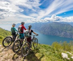
Planning route elevation gain can make or break your outdoor adventure. Knowing how to calculate climbs, descents, and overall effort allows for safer, more enjoyable experiences. This guide covers practical methods, digital tools, and planning strategies to optimize your journey while minimizing fatigue.

Understanding route elevation gain
Elevation gain refers to the total vertical distance you ascend over the course of a route. It’s a critical factor for hikers, cyclists, and trail runners because it directly impacts the difficulty, energy expenditure, and required pacing of your journey.
Why elevation gain matters
Ignoring elevation can lead to underestimating the challenge of a route. Even short distances with steep climbs can tire you quickly, while longer, flatter routes might seem deceptively easy. Understanding elevation gain helps in planning rest stops, hydration, and nutrition strategies.
Impact on energy expenditure: More climbing means more calories burned.
Influences pacing: Steep ascents require slower, controlled effort.
Affects gear choice: Proper shoes, trekking poles, or bike gearing.
Safety planning: Helps anticipate fatigue and risk of injury.

Measuring elevation gain accurately
To plan your route effectively, you need precise measurements. Elevation gain can be calculated using topographic maps, GPS devices, or digital mapping software. Each method has its advantages and potential pitfalls.
Using topographic maps
Topographic maps display contour lines that indicate elevation changes. By counting the lines and noting their intervals, you can estimate total ascent and descent. While this method requires careful attention, it doesn’t rely on technology.
Identify start and end points of your route.
Count contour lines crossed along the path.
Multiply the number of lines by the contour interval to get total elevation gain.
Adjust for small undulations that may not be captured in the map scale.
Using GPS devices and apps
Modern GPS watches, bike computers, and smartphones can track elevation gain in real time. Apps like Strava, Komoot, and Gaia GPS provide automatic calculations and visualize climbs with elevation profiles. Accuracy may vary depending on satellite coverage and barometric sensors.
Ensure device calibration before starting.
Check elevation profiles post-activity for total gain.
Use apps with correction algorithms for more precise readings.
Digital mapping software
Software like Google Earth, Ride with GPS, or MapMyRun allows detailed route planning with integrated elevation data. These platforms can generate profiles, highlight steep sections, and offer alternative routes based on your fitness level.
Draw your intended route on the map.
Review the elevation profile for climbs and descents.
Adjust route to match desired difficulty and safety considerations.

Planning strategies for route elevation
After measuring elevation gain, the next step is designing a plan that matches your goals and fitness. Effective planning ensures that climbs are manageable and that energy reserves last throughout the journey.
Match your fitness level
Choose routes that align with your training and experience. Beginners may prefer routes with gradual climbs and fewer elevation meters, while experienced hikers and cyclists can challenge themselves with steep ascents and long elevation gains.
Start with shorter climbs before tackling major ascents.
Incorporate strength and endurance training for sustained elevation gain.
Use incremental increases in elevation to prevent overexertion.
Consider terrain and conditions
Elevation gain is affected by terrain type and environmental conditions. Loose gravel, mud, or snow can make climbs more challenging, while smooth trails or paved roads reduce difficulty. Weather factors such as heat, wind, and rain also influence exertion.
Check trail conditions and weather forecasts.
Adjust pacing and rest intervals accordingly.
Bring appropriate gear for technical or slippery terrain.
Segment your route
Breaking your route into segments with defined elevation targets helps manage effort and timing. Each segment can have a planned pace, hydration stop, or nutrition break to prevent fatigue and maintain steady performance.
Divide steep climbs into shorter intervals.
Plan recovery periods at flat sections or summits.
Track progress using GPS or digital maps to stay on schedule.
YOU MAY ALSO BE INTERESTED